
With our service, you can transform complex information into beautifully crafted, interactive maps. Whether you need a seamless Google Maps integration or a fully custom, hand-drawn map with a clean, minimalist digital design, we build visual displays that fit your exact needs. You can also easily link specific points of interest directly to related articles, external websites, or your internal systems.
Every business has its own unique identity, and your data visualization should reflect that. If standard map providers don't quite hit the mark, our in-house UI/UX designers will craft a bespoke map tailored specifically to your company's personality and branding, ensuring your data stands out.
How It Works

Share Your Data
Tell us exactly what information or locations you want to showcase.

Get a Quote & Timeline
We will provide a clear, upfront cost estimate and project schedule.

Development Phase
Once you give the green light, our team starts designing and coding your map.

Ready to Launch
Your custom interactive map is fully deployed and ready to engage your users.
Need a Different Approach? No Problem
Tell us how your team operates, and we will adapt our development lifecycle to fit your specific business processes.
Need a Different Approach? No Problem
Tell us how your team operates, and we will adapt our development lifecycle to fit your specific business processes.
See Our Expertise in Action
Indonesian Geographic Index (IGI): Interactive Map & Display
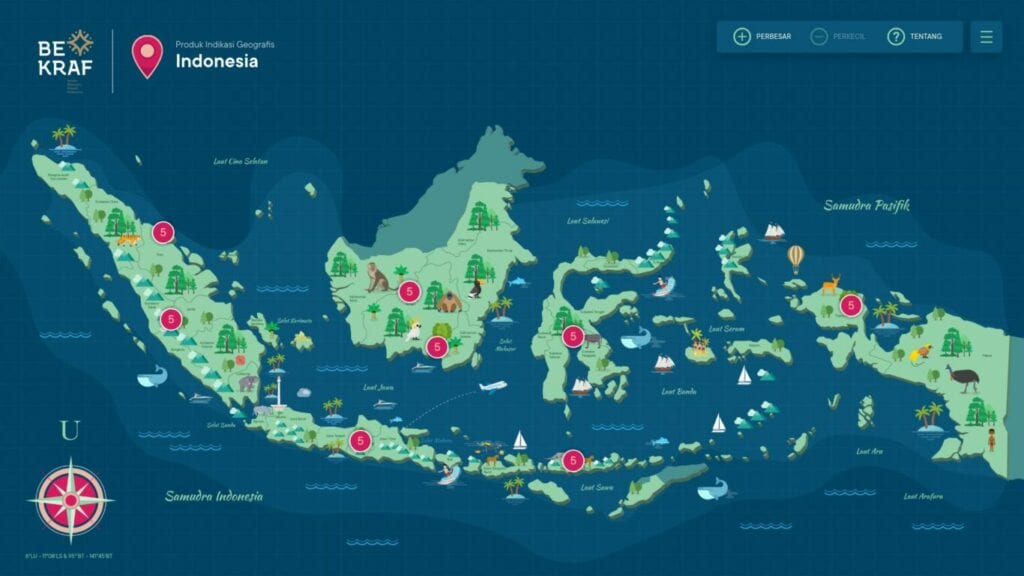
We built a custom interactive desktop application designed specifically to showcase the Geographical Indications of Indonesia (IGI). Developed for high-traffic exhibition environments, this platform serves as an engaging digital map that allows users to explore regional intellectual property seamlessly. To further maximize visitor engagement during the event, we also integrated custom interactive mini-games directly into the display system.
Project Type : Interactive Map & Exhibition Display
Project Date : 2019
See Our Expertise in Action
Indonesian Geographic Index (IGI): Interactive Map & Display
We built a custom interactive desktop application designed specifically to showcase the Geographical Indications of Indonesia (IGI). Developed for high-traffic exhibition environments, this platform serves as an engaging digital map that allows users to explore regional intellectual property seamlessly. To further maximize visitor engagement during the event, we also integrated custom interactive mini-games directly into the display system.
Project Type : Interactive Map & Exhibition Display
Project Date : 2019